Platform, systems, and methods for identifying property characteristics and property feature maintenance through aerial imagery analysis
Patent No. US10529029 (titled "Platform, systems, and methods for identifying property characteristics and property feature maintenance through aerial imagery analysis") on Sep 25, 2017. The application was issued on Jan 7, 2020.
What is this patent about?
’029 is related to the field of automated property assessment and risk management. Traditionally, evaluating the physical state of a building—such as the structural integrity of a roof or the quality of exterior cladding—required manual on-site inspections or the review of outdated municipal records. This process was often slow, subjective, and expensive for insurance carriers and real estate investors who need to quantify risk across large portfolios of properties. The invention seeks to modernize this by leveraging high-resolution imagery and computer vision to remotely diagnose property health.
The underlying idea behind ’029 is the use of a dual-stage machine learning pipeline to transform raw pixels from aerial imagery into actionable financial and risk metrics. Rather than just identifying that a building exists, the system first isolates specific architectural features, such as rooftop shapes, and then subjects those specific regions to a secondary analysis to detect signs of wear, weathering, or damage. By combining the structural type of a feature with its current physical state, the system can generate highly specific predictions regarding how a property will perform during a catastrophe or what it will cost to restore.
The claims of ’029 focus on a computer-implemented method and system that receives a property identifier and uses processing circuitry to extract pixel groupings from aerial images. The independent claims require a two-step classification process: a first machine learning classifier identifies the specific property characteristic, while a second machine learning classifier determines the condition of that identified characteristic. This specific sequence allows the system to calculate real-time outputs, specifically disaster risk estimates and replacement costs, which are then delivered back to a user through a graphical interface.
In practice, the invention functions by first aligning aerial photos with municipal shape maps to ensure the analysis is focused on the correct parcel boundaries. Once the property is isolated, the system uses deep learning architectures, such as Network in Network (NIN), to categorize features like gable or hip roofs. Following this, the system performs a color histogram analysis to evaluate pixel intensity distributions. A new roof typically exhibits sharp contrasts and uniform colors, whereas a deteriorating roof shows blurred edges and patchy, asymmetrical pixel distributions that the system flags as a high-risk condition.
This approach differs from prior solutions by moving beyond simple object detection to provide a qualitative assessment of maintenance levels. While older systems might identify a roof's presence, ’029 integrates the vulnerability profiles of specific shapes—such as the high wind sensitivity of a gambrel roof—with the detected wear and tear of that specific instance. By automating this link between visual condition and actuarial risk, the system enables insurance providers to generate real-time cost estimates and verify repairs without the latency of a human inspector.
How does this patent fit in bigger picture?
Technical Landscape
In the mid-2010s when ’029 was filed, property assessment and risk modeling were typically implemented using manual on-site inspections or the analysis of official building documentation, at a time when large-scale database population relied on human-verified data entry for structural characteristics. When systems commonly relied on static, historical records rather than automated visual extraction, the identification of specific building features like roof shape or maintenance condition was often limited by the availability of recent physical surveys. During this era, hardware and software constraints made the real-time, high-resolution processing of unstructured aerial imagery non-trivial, as computational models for automated feature extraction were often siloed from actuarial risk-estimation frameworks.
Prosecution Position
The disclosed invention represents a meaningful technical advancement through the integration of deep learning architectures with multi-modal image analysis to automate the generation of property-specific risk profiles. By implementing a dual-classification pipeline—where a deep learning model identifies structural characteristics such as roof shape while a separate machine learning model, such as color histogram analysis, evaluates the repair condition of those features—the system achieves a granular assessment of property vulnerability that exceeds the capabilities of manual data collection. This architectural shift enables the transformation of raw aerial pixels into actionable risk estimates and replacement cost calculations, overcoming the technical constraint of relying on outdated or subjective human inspections for large-scale insurance and disaster modeling.
Claims
This patent contains 20 claims, with claims 1, 8, and 15 serving as the independent claims. The independent claims focus on a method, system, and computer-readable medium for automatically categorizing property repair conditions by processing aerial images through machine learning classifiers to identify specific property characteristics, determine their condition, and calculate associated disaster risk estimates or replacement costs. The dependent claims serve to further define the technical implementation, such as specifying the use of pixel intensity distributions, Network in Network classifiers, orthogonality corrections for imagery, and the integration of historical data or terrestrial images to refine risk assessments and property boundaries.
Key Claim Terms New
Definitions of key terms used in the patent claims.
Litigation Cases New
US Latest litigation cases involving this patent.
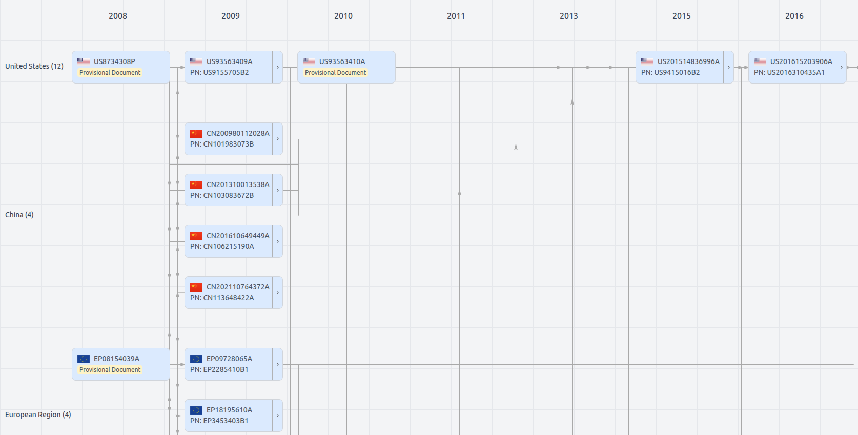
Patent Family
File Wrapper
The dossier documents provide a comprehensive record of the patent's prosecution history - including filings, correspondence, and decisions made by patent offices - and are crucial for understanding the patent's legal journey and any challenges it may have faced during examination.
US10529029
- Application Number
- US15714376A
- Filing Date
- Sep 25, 2017
- Publication Date
- Jan 7, 2020
- External Links
- Slate, USPTO , Google Patents