Method And System For Providing Travel Time Information
Patent No. US11307048 (titled "Method And System For Providing Travel Time Information") was filed by Nortrup Edward H on Oct 12, 2019.
What is this patent about?
’048 is related to the field of navigation systems and, more specifically, to providing real-time traffic information and route guidance to drivers. Existing navigation systems often lack accurate, up-to-date traffic data, leading to inefficient routes and increased travel times. This patent aims to improve route planning by incorporating real-time traffic data derived from the locations of other mobile devices.
The underlying idea behind ’048 is to leverage the ubiquity of cell phones as traffic sensors . By tracking the locations and speeds of a large number of cell phones, the system can infer real-time traffic conditions on roadways. This data is then used to estimate traffic conditions and provide drivers with optimized routes that avoid congestion.
The claims of ’048 focus on an in-vehicle computer system that receives a roadway map and a route to a destination. The route is determined based on an estimated roadway traffic condition. Crucially, this traffic condition is estimated using location data from a plurality of other cell phones, presumed to be in moving vehicles based on their proximity to roadways or their calculated speed.
In practice, the system works by continuously collecting location data from cell phones. The system filters this data to identify cell phones likely to be in vehicles, using criteria like proximity to roads and speed. The aggregated location and speed data is then used to estimate traffic density and flow on different road segments. This information is used to generate a visual indication of traffic conditions on a roadway map, which is displayed to the driver, along with a route that takes into account the estimated traffic.
This approach differs from traditional traffic monitoring methods, which rely on fixed sensors or manual observation. By using cell phones as mobile traffic probes , the system can provide more comprehensive and up-to-date traffic information, especially in areas where traditional monitoring infrastructure is limited. The system's ability to infer vehicle presence based on cell phone data also allows it to estimate traffic conditions without requiring explicit user input or participation.
How does this patent fit in bigger picture?
Technical landscape at the time
In the early 2000s when ’048 was filed, systems commonly relied on GPS for location data, at a time when mobile devices had limited processing power and memory, which made complex real-time data processing and storage non-trivial. At a time when wireless communication bandwidth was constrained, transmitting large amounts of data, such as detailed maps or real-time video, was typically implemented using compression techniques and optimized protocols.
Novelty and Inventive Step
The examiner approved the application after an examiner's amendment to the claims. The allowed claims are directed to an in-vehicle computer system that receives a roadway map and a route based on estimated traffic conditions from a cell phone. The estimated traffic condition is based on the location and speed of other cell phones, and the system displays the map and route.
Claims
This patent includes 18 claims, with independent claims numbered 1, 13, 15, and 17; these independent claims generally focus on an in-vehicle or general computer system that receives and displays a roadway map and route based on estimated traffic conditions derived from the location data of other cell phones. The dependent claims generally elaborate on and add detail to the features described in the independent claims.
Key Claim Terms New
Definitions of key terms used in the patent claims.
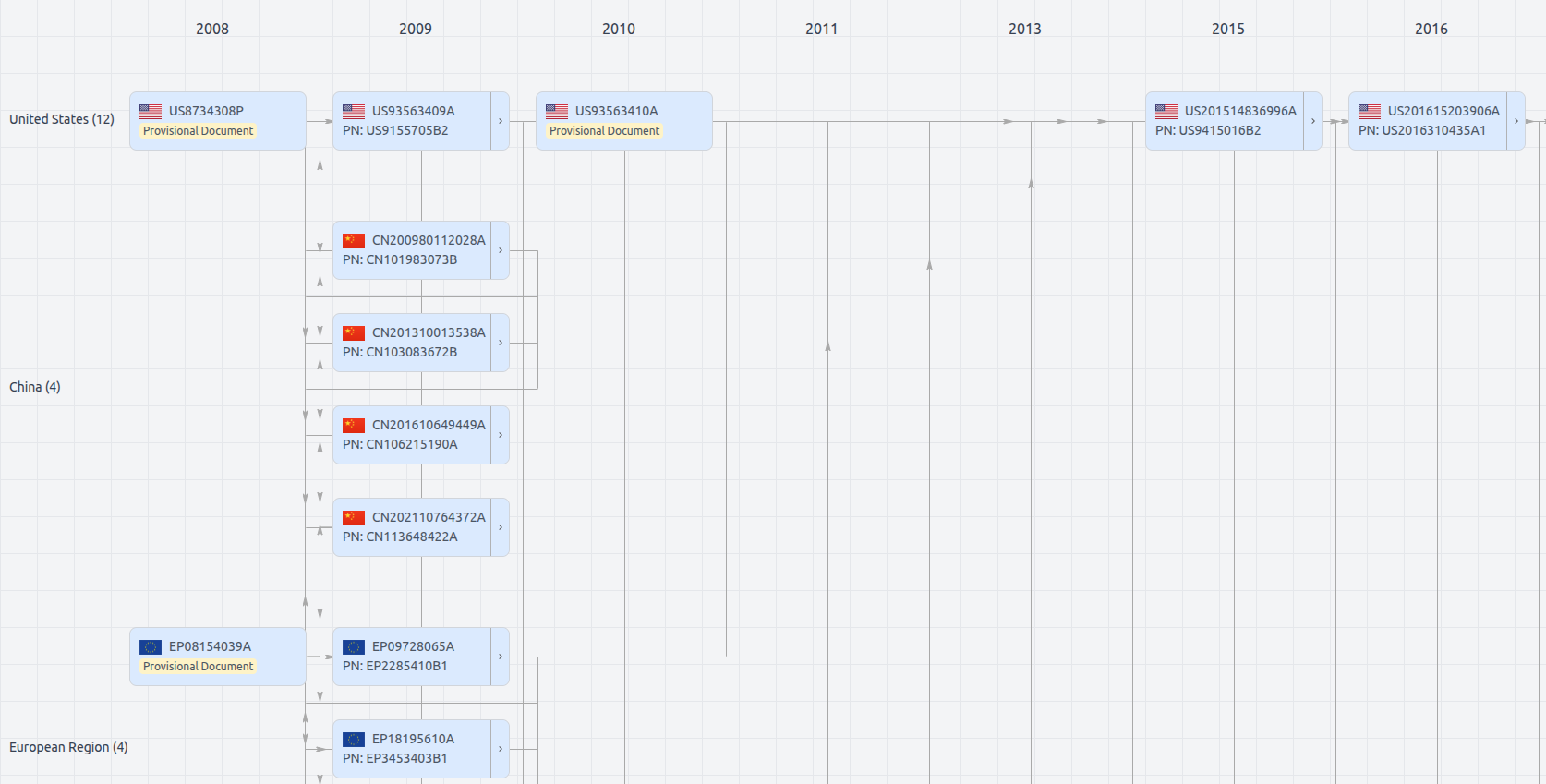
Patent Family
File Wrapper
The dossier documents provide a comprehensive record of the patent's prosecution history - including filings, correspondence, and decisions made by patent offices - and are crucial for understanding the patent's legal journey and any challenges it may have faced during examination.
Get instant alerts for new documents
US11307048
- Application Number
- US16600480
- Filing Date
- Oct 12, 2019
- Status
- Expired
- Expiry Date
- Feb 7, 2025
- External Links
- Slate, USPTO, Google Patents