Method And System For Map Construction
Patent No. US12190609 (titled "Method And System For Map Construction") was filed by Createai Inc on Jul 27, 2023.
What is this patent about?
’609 is related to the field of map construction , particularly the automated generation of lane-level roadmaps from raw image data. Traditional mapmaking is labor-intensive and expensive, requiring a balance between accuracy and cost. This patent addresses the problem of efficiently creating accurate maps suitable for advanced navigation and autonomous driving systems.
The underlying idea behind ’609 is to automate the process of extracting lane geometry from road images by first creating a simplified representation of the road using polylines , then partitioning these polylines into segments. These segments are then used to construct a general outline of the road and, subsequently, to identify the individual outlines of each lane within that road.
The claims of ’609 focus on a method, a system, and a non-transitory computer readable storage medium for constructing a map. The key steps involve constructing an outline that encompasses multiple lanes on a road, using segments derived from polylines that represent the road's shape. These segments are created at the start, end, and turning points of the polylines. The individual outlines of each lane are then identified based on these segments and the overall outline.
In practice, the system receives raw image data, possibly from a vehicle's camera and GPS. This data is visualized as a dot plot, which is then converted into a polyline plot. The polylines are segmented, and a lane geometry construction circuit builds a general outline around all lanes. A lane identification circuit then uses the segments and the general outline to determine the boundaries of each lane. This process may involve smoothing the lane boundaries using techniques like B-spline transformation and generating waypoints for navigation.
The invention differentiates itself by automating the lane extraction process. Instead of manual digitization or relying solely on GPS data, it uses image processing to identify lane markings and boundaries. The grid-based approach for map extraction allows for efficient retrieval of lane segment data based on the vehicle's location. This automated approach reduces the cost and effort associated with creating and maintaining accurate lane-level roadmaps, making it suitable for real-time navigation and autonomous driving applications.
How does this patent fit in bigger picture?
Technical landscape at the time
In the late 2010s when ’609 was filed, mapmaking technology was at a time when systems commonly relied on GPS data and pre-existing map databases for navigation, when hardware or software constraints made real-time, high-accuracy map construction from sensor data non-trivial, and at a time when X was typically implemented using Y.
Novelty and Inventive Step
The application was examined, and claims 1-20 were pending. A final rejection was issued. Claims 1, 2, 9-14, 16 and 17 were rejected under 35 U.S.C. 102(a)(1) as being anticipated by a prior art reference. Claims 3-8, 15 and 18-20 were objected to as being dependent upon a rejected base claim.
Claims
This patent includes 20 claims, with independent claims 1, 9, and 14. The independent claims are directed to a method, a system, and a non-transitory computer readable storage medium for map construction by constructing an outline circumscribing lanes on a road and identifying individual lane outlines. The dependent claims generally elaborate on and refine the specifics of the method, system, and storage medium described in the independent claims.
Key Claim Terms New
Definitions of key terms used in the patent claims.
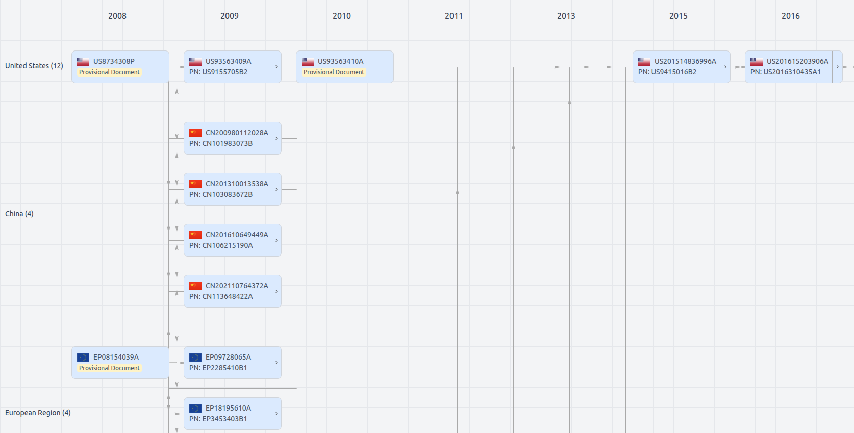
Patent Family
File Wrapper
The dossier documents provide a comprehensive record of the patent's prosecution history - including filings, correspondence, and decisions made by patent offices - and are crucial for understanding the patent's legal journey and any challenges it may have faced during examination.
Get instant alerts for new documents
US12190609
- Application Number
- US18360556
- Filing Date
- Jul 27, 2023
- Status
- Granted
- Expiry Date
- Feb 26, 2039
- External Links
- Slate, USPTO, Google Patents