Creating a projection of a situational network
Patent No. US8332454 (titled "Creating a projection of a situational network") on Oct 17, 2011. The application was issued on Dec 11, 2012.
What is this patent about?
’454 is related to the field of situational social networking and dynamic information aggregation. It addresses the technical challenge of connecting disparate users who may have no prior relationship but are suddenly linked by a common, often urgent, external event such as a natural disaster, traffic incident, or public health crisis. Traditional social networks rely on pre-existing static connections, which are insufficient for real-time coordination during localized emergencies where geographic proximity and situational relevance are the primary drivers for information exchange.
The underlying idea behind ’454 is the use of a multi-dimensional personal information network to dynamically filter and connect users based on their physical location relative to a specific event. By treating a situation as a distinct event node within a broader social graph, the system can perform a spatial query to identify which users are currently affected or will soon be affected by the event. This allows for the creation of a temporary, high-affinity network that exists only as long as the situation persists, enabling targeted communication without requiring users to manually find and add one another during a crisis.
The claims of ’454 focus on a method and system for generating a projection of nodes within a multi-dimensional network based on geographic coordinates. The process involves an event node server identifying devices within a specific geographic boundary, issuing invitations to those devices to join a situational link, and establishing a formal connection upon acceptance. This architecture ensures that the resulting situational network is populated only by relevant participants, facilitating the bidirectional flow of information between a central authority and the devices located on the ground.
In practice, the invention functions by monitoring the movement of devices relative to a dynamic event, such as a hurricane's trajectory or a spreading wildfire. When a device enters the affected zone, the event node server triggers an invitation, effectively pulling the user into a specialized communication tier. This implementation allows for tiered access levels, where emergency responders, affected residents, and relief agencies can share high-priority data, such as road closures or medical needs, while filtering out noise from users outside the immediate geographic projection.
This approach differs from prior solutions by moving away from static friend lists and toward temporally limited links defined by the event's lifecycle. Unlike standard location-based services that merely push notifications, this system establishes a formal link within a multi-dimensional social framework, allowing for complex interactions like peer-to-peer data sharing and roll-call features. By leveraging the personal information aggregator at each node, the network can prioritize information based on specific user needs—such as medical conditions or pet ownership—ensuring that the right resources reach the right individuals during a crisis.
How does this patent fit in bigger picture?
Technical Landscape
In the mid-2000s when ’454 was filed, mobile data services and navigation systems were typically implemented using static client-server architectures where location-based information was retrieved from centralized databases. At a time when wireless networking commonly relied on fixed infrastructure for data routing rather than dynamic peer-to-peer or ad-hoc formations, the integration of real-time situational data across disparate mobile nodes was limited by bandwidth and the lack of standardized protocols for spontaneous network creation. Hardware and software constraints made the real-time aggregation of personal information and environmental context non-trivial, often resulting in isolated data silos that could not adapt to the immediate geographic or social proximity of the user.
Prosecution Position
The disclosed invention represents a technical advancement through the architectural shift toward situational networks that dynamically aggregate personal information and environmental data based on proximity and shared context. By establishing a projection of a situational network, the system enables the integration of real-time navigation, emergency response, and location-based services within a transient, ad-hoc framework. This approach overcomes the technical constraint of static data retrieval by allowing for the spontaneous discovery and exchange of information between nodes, achieving a technical effect where the network topology and available information evolve in direct response to the changing physical and logical state of the participating entities.
Claims
This patent contains a total of 20 claims, with claims 1, 10, and 20 serving as the independent claims. The independent claims focus on the technical processes and system architectures required to create a situational network projection by identifying device locations within a multi-dimensional personal information network, issuing invitations to those devices, and establishing communication links to share situational data. The dependent claims serve to further define the network by specifying the types of information exchanged, such as weather data or advertisements, detailing the role of situation authorities, and describing the specific multidimensional connection parameters and affinities between participating devices.
Key Claim Terms New
Definitions of key terms used in the patent claims.
Litigation Cases New
US Latest litigation cases involving this patent.
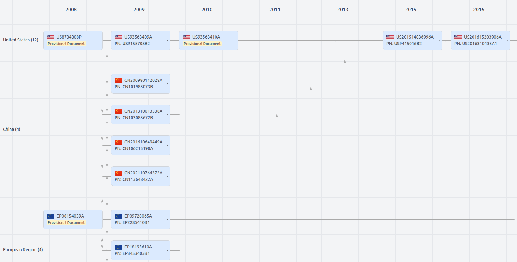
Patent Family
File Wrapper
The dossier documents provide a comprehensive record of the patent's prosecution history - including filings, correspondence, and decisions made by patent offices - and are crucial for understanding the patent's legal journey and any challenges it may have faced during examination.
US8332454
- Application Number
- US13274712A
- Filing Date
- Oct 17, 2011
- Publication Date
- Dec 11, 2012
- External Links
- Slate, USPTO , Google Patents