Spectral image classification of rooftop condition for use in property insurance
Patent No. US8775219 (titled "Spectral image classification of rooftop condition for use in property insurance") on Jul 13, 2012. The application was issued on Jul 8, 2014.
What is this patent about?
’219 is related to the field of remote sensing and property insurance analytics. Specifically, it addresses the technical challenges of accurately assessing the physical state of residential and commercial rooftops across large geographic regions. Traditional manual inspections are costly, subjective, and difficult to scale, often leading to inaccurate property liability assessments when insurers cannot verify if a roof is nearing the end of its functional life or has sustained specific environmental damage.
The underlying idea behind ’219 is that different roofing materials and their respective stages of decay exhibit unique spectral signatures that can be captured from the air. By leveraging hyperspectral or multispectral imaging, the system identifies subtle changes in reflectance—particularly in the short-wave infrared spectrum—that correlate to aging, UV degradation, and structural wear. This allows for a quantitative, automated determination of a roof's condition by comparing aerial data against a controlled library of known material responses.
The claims of ’219 focus on a coordinated system and method that integrates high-resolution spectral imaging with geospatial modeling to generate insurance liability reports. The process involves building a database of reference spectra for various roofing materials, identifying specific roof objects within a geographic area using aerial photography, and then performing a pixel-level comparison between the captured spectral images and the reference database. The resulting characterization of the roof's condition is then tied to specific property parcels to calculate risk.
In practice, the invention functions by deploying sensors on an airborne platform to collect a data cube containing both spatial and spectral information. The system processes this data to remove atmospheric distortions and aligns it with GPS coordinates to ensure each spectral reading is mapped to the correct building. A critical component is the spectral library, which includes data on how materials like asphalt shingles, wood shakes, and tile change over time due to factors such as mineral loss, bitumen oxidation, and hail strikes.
This approach differs from prior solutions by moving beyond simple color photography, which only provides a qualitative view of a property. While standard aerial images can show a roof's color, they cannot detect the chemical and physical degradation of the substrate. By using spectrally relative reflectivity, the ’219 invention can distinguish between a roof that is merely dirty and one that has lost its structural integrity, providing insurers with a standardized, reproducible metric for assessing replacement costs and natural disaster risk.
How does this patent fit in bigger picture?
Technical Landscape
In the early 2010s when ’219 was filed, property assessment for insurance purposes was typically implemented using manual on-site visual inspections or low-altitude color digital photography. At a time when systems commonly relied on human inspectors to physically climb structures or drive to disparate geographic locations, the evaluation of material degradation was largely qualitative and prone to subjective variability. While remote sensing technologies existed, hardware and software constraints made the large-scale automated identification of specific material wear non-trivial, as standard aerial imagery lacked the spectral resolution to distinguish between new and weathered surfaces. Consequently, data collection for insurance liability was often restricted to static, low-resolution snapshots that could identify the presence of a structure but not the functional integrity or precise age of its components.
Prosecution Position
The disclosed invention represents a technical advancement through the integration of high-resolution hyperspectral or multispectral imaging with geospatial modeling to automate the assessment of material conditions. By establishing a database of reference spectra that specifically accounts for aging, weathering, and environmental impacts, the system shifts from qualitative visual estimation to quantitative spectral analysis. This architectural approach enables the identification of roof objects within a geographic model and the subsequent characterization of their physical state by comparing captured spectral reflectance against known degradation signatures. The technical effect achieved is the ability to generate objective, reproducible property liability assessments across vast geographic domains, overcoming the constraints of manual inspection speed, cost, and inconsistency.
Claims
The patent contains a total of 20 claims, with claims 1, 7, 12, and 18 serving as the independent claims. These independent claims focus on a method, system, business process, and computer program product for aerially assessing roof conditions and determining property liability by comparing collected hyperspectral or multi-spectral imagery against a database of spectral information for roof materials. The dependent claims serve to further define technical specifications such as the use of space-borne imagers, specific types of spectral response curves related to weathering or aging, and the generation of liability reports in the form of maps or data tables.
Key Claim Terms New
Definitions of key terms used in the patent claims.
Litigation Cases New
US Latest litigation cases involving this patent.
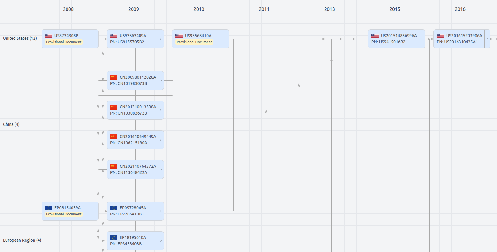
Patent Family
File Wrapper
The dossier documents provide a comprehensive record of the patent's prosecution history - including filings, correspondence, and decisions made by patent offices - and are crucial for understanding the patent's legal journey and any challenges it may have faced during examination.
US8775219
- Application Number
- US13548878A
- Filing Date
- Jul 13, 2012
- Publication Date
- Jul 8, 2014
- External Links
- Slate, USPTO , Google Patents