Method to provide ad hoc and password protected digital and voice networks
Patent No. US9467838 (titled "Method to provide ad hoc and password protected digital and voice networks") on Oct 31, 2014. The application was issued on Oct 11, 2016.
What is this patent about?
'838 is related to the field of mobile communication systems, particularly those used in ad hoc networks for coordinating activities among a group of users. The background involves scenarios where rapid deployment and coordination are critical, such as emergency response, military operations, or large-scale events. Traditional communication methods often require pre-configuration and knowledge of contact information, which can be cumbersome and time-consuming in dynamic situations.
The underlying idea behind '838 is to enable the rapid formation of a communication network by leveraging a central server to manage user locations and data exchange. Users join a network by providing a group identifier (e.g., an event name and password), and the system automatically shares location and status information among participants. The key inventive insight is to use a georeferenced map interface where users can interact with symbols representing other participants, enabling intuitive communication and coordination.
The claims of '838 focus on a system and method where a device joins a communication network by transmitting a group identifier. The device then sends its location to a server and receives location information from other devices in the group. The device displays a georeferenced map with symbols representing other users, allowing a user to select a symbol and initiate an action (e.g., sending data) to the corresponding device. The claims also cover requesting and displaying different georeferenced map data from a second server.
In practice, the invention allows first responders at a disaster scene to quickly establish a communication network by entering a common event name and password. Each user's device displays a map showing the location of other team members, and users can tap on a team member's icon to send a message or initiate a voice call. The system also supports switching between different map sources, such as satellite imagery or building floor plans, to provide more relevant situational awareness. This eliminates the need for manual contact entry and facilitates real-time coordination.
The invention differentiates itself from prior approaches by providing a seamless and intuitive way to establish and manage ad hoc communication networks. Unlike traditional systems that require pre-configured contact lists or complex setup procedures, '838 enables users to quickly join a network and begin communicating with others based on their location and role. The use of a georeferenced map interface further enhances situational awareness and simplifies communication, making it easier for users to coordinate their activities in dynamic and time-sensitive environments. The ability to switch map data sources adds another layer of adaptability.
How does this patent fit in bigger picture?
Technical Landscape
In the mid-2000s when ’838 was filed, mobile data communication was typically implemented using early-generation IP-capable cellular handsets that functioned as distinct silos of information. At a time when systems commonly relied on pre-configured contact lists and static server entries to facilitate group coordination, the dynamic formation of secure, ad hoc networks was limited by the manual overhead of exchanging identifiers like phone numbers or email addresses. Furthermore, hardware and software constraints of the era made the real-time integration of GPS location data with interactive, touch-sensitive mapping interfaces non-trivial, often requiring specialized equipment rather than standard consumer mobile devices.
Prosecution Position
The examiner allowed the application because the prior art failed to disclose a specific sequence of technical steps for managing group communications through interactive mapping. Specifically, the allowed claims involve a device joining a group by sending a group identifier and its own location to a first server, then receiving the locations of other group members to display them as selectable symbols on a georeferenced map. The examiner noted that the prior art did not teach the subsequent step of requesting and receiving a second, different set of georeferenced map data from a second server, displaying new symbols on that second map, and allowing a user to trigger a specific action for selected group members by interacting with that second display.
Claims
This patent includes 84 claims, with independent claims numbered 1, 54, 55, and 84. The independent claims generally focus on a system and method for devices to join a communication network, share location information, display georeferenced maps with user-selectable symbols representing other devices, and send data to selected devices. The dependent claims generally elaborate on and refine the specifics of the independent claims, adding details and limitations to the methods and systems described.
Key Claim Terms New
Definitions of key terms used in the patent claims.
Litigation Cases New
US Latest litigation cases involving this patent.
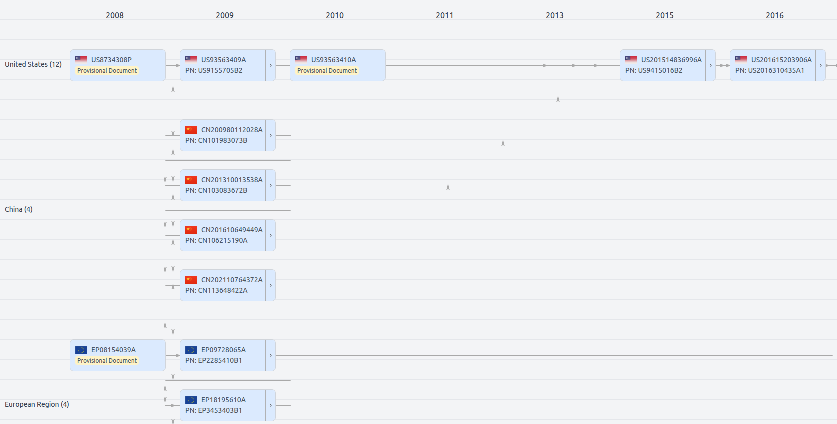
Patent Family
File Wrapper
The dossier documents provide a comprehensive record of the patent's prosecution history - including filings, correspondence, and decisions made by patent offices - and are crucial for understanding the patent's legal journey and any challenges it may have faced during examination.
Get instant alerts for new documents
US9467838
- Application Number
- US14529978A
- Filing Date
- Oct 31, 2014
- Publication Date
- Oct 11, 2016
- External Links
- Slate, USPTO , Google Patents